Mapping Services
Survey-grade LiDAR, GIS mapping, and route surveys — collected aerially and processed in-house by our engineering team
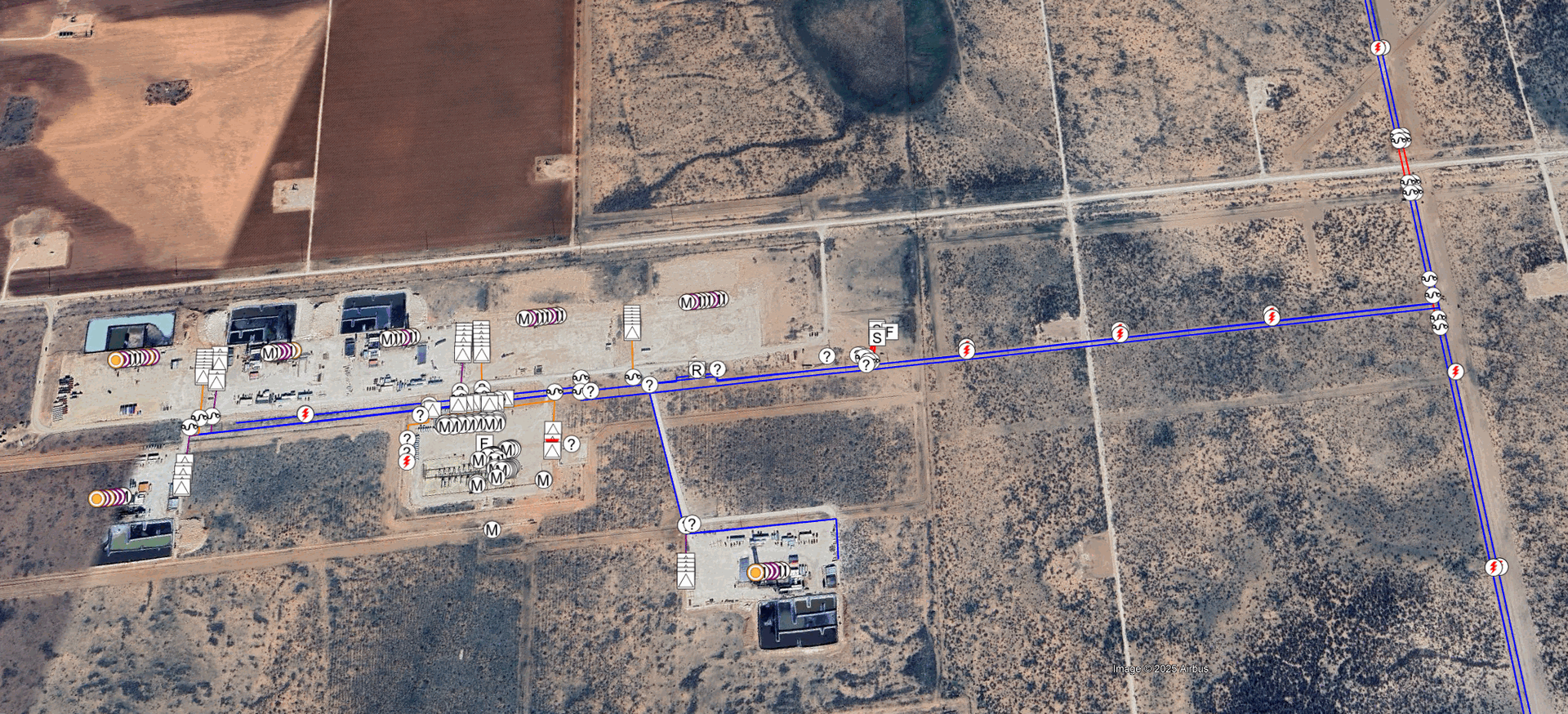
Asset Mapping
We build and maintain GIS datasets for power distribution systems, pipeline networks, and industrial facilities. Using centimeter-level aerial imagery combined with survey-grade ground control, our team creates orthomosaic maps, feature layers, and digital elevation models tied to your coordinate system.
Deliverables are provided in industry-standard formats — shapefile, geodatabase, DXF, or KMZ — ready to load into your existing GIS platform for planning, permitting, and ongoing asset management.
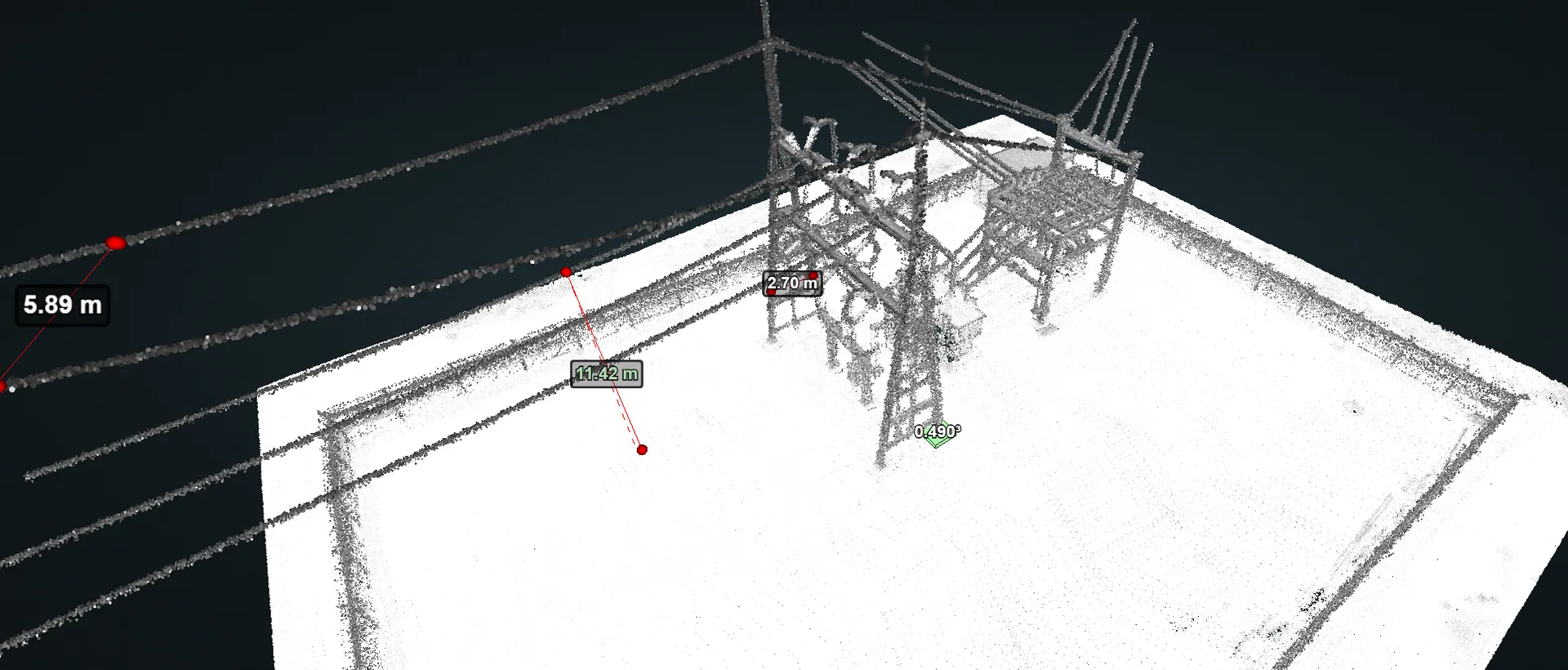
LiDAR Mapping
Our UAV-mounted LiDAR sensors collect dense 3D point clouds that we classify and process in-house into digital terrain models, surface models, and vegetation canopy analyses. Ground control points are established to meet project accuracy requirements, and all data is referenced to the client's coordinate system.
LiDAR mapping is well suited for transmission corridor surveys, substation site plans, volumetric calculations, and vegetation management programs where sub-foot accuracy and canopy penetration are critical.
Route Mapping
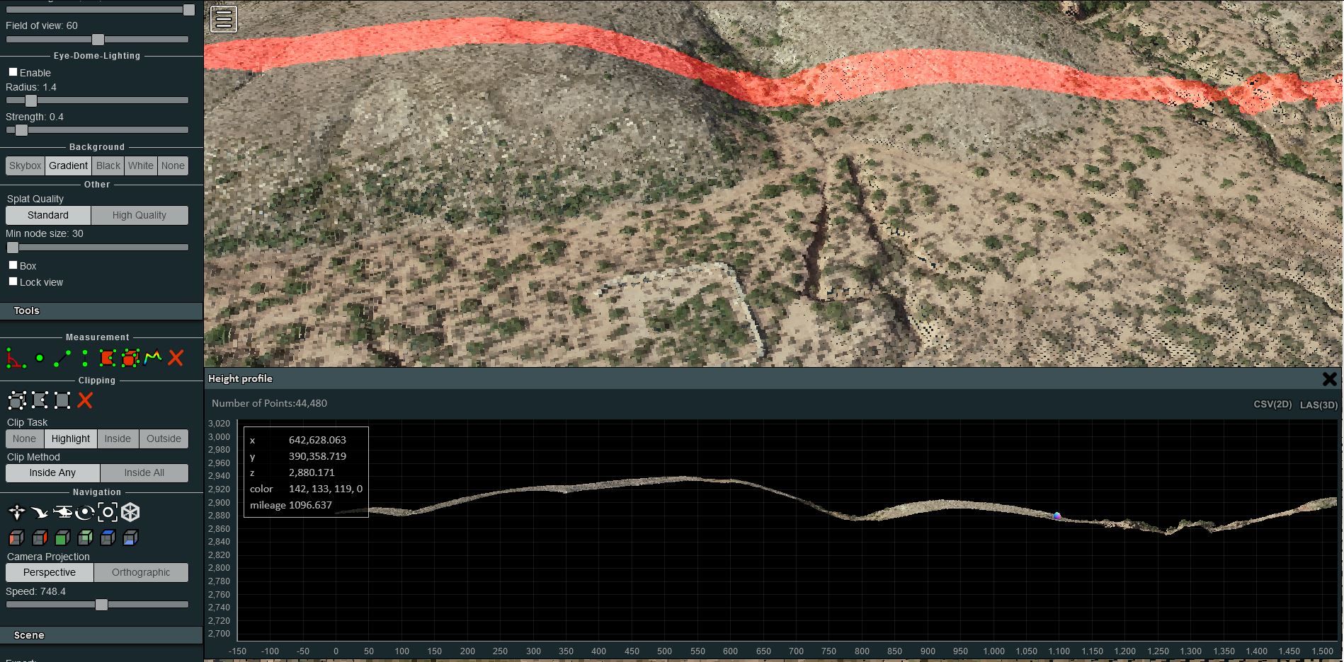
We perform corridor surveys for new and existing power lines, pipelines, and transmission routes. Aerial data collection captures right-of-way profiles, obstruction heights, and span clearances that feed directly into PLS-CADD and other engineering design tools.
Deliverables include plan-and-profile sheets, clearance reports, crossing analyses, and as-built alignment records — giving your engineering and permitting teams the data they need without repeat mobilizations.
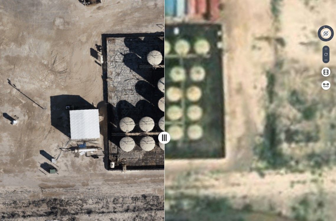
Data Processing
All mapping data is processed in-house by our survey and engineering teams — you receive finished, quality-checked products rather than raw data files. Our pipeline includes point cloud classification, ground surface extraction, orthomosaic generation, and feature digitization.
Final deliverables are provided in your preferred format (DXF, shapefile, geodatabase, LAS/LAZ, GeoTIFF) with accuracy reports and metadata documentation. This end-to-end approach eliminates handoff delays and keeps quality control under one roof.
Need Mapping or GIS Services?
Asset mapping, LiDAR surveys, route mapping, and in-house data processing — we deliver finished products, not raw data.